WILCOX STUDIES | BEE-VICTORIA | ZAPATA | WORKFLOW | INFORMATION
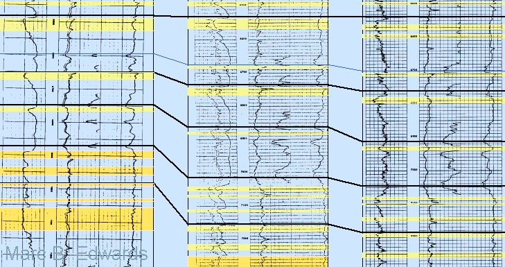
Correlating Raster Well Logs in a Workstation Environment
Correlation Strategies
As reflected in my previous studies , I am more interested in practical approaches of greatest value to the G&G team conducting exploration and production than in the arcana of stratigraphic terminology. This is reflected in my utilizing A2D Technologies’ cross section application to build cross sections and use them to generate key data for subsurface work. The diagrams below are screen captures of working sessions in the application.
The dominant sedimentary motif is the coarsening upward sequence which reflects progradation by deltaic to strandplain environments. The individual sequences are bounded by transgressive shales, or flooding surfaces (see Figure). This figure illustrates a partially interpreted cross section showing a flattened stratigraphic section with color fill and counted sand intervals (yellow). These regional to sub-regional flooding surfaces are one of the major boundaries that are used to define units for isopach, sand and log facies mapping. Additional bounding surfaces may be represented by local erosion surfaces, and sub-regional erosion surfaces that can form by several processes. The most dramatic process is shelf margin collapse (see article – received Grover E. Murray Best Published Paper Award – in GCAGS Transactions for 2000).
Correlation Anomalies
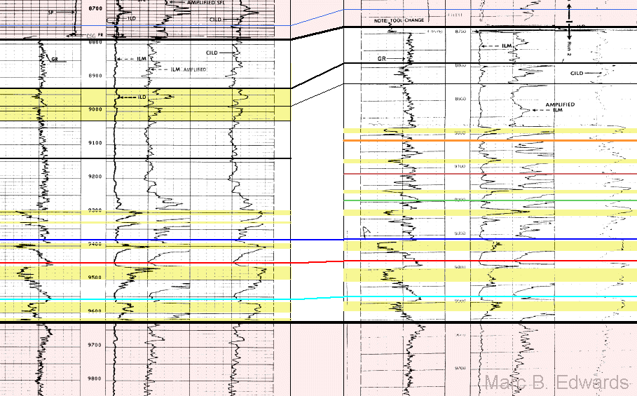
Some anomalies cannot be explained by faulting. Note in this example how some flooding surfaces can be readily correlated between two nearby wells, whereas others can not. In these cases the study provides models for such anomalies and maps them out in detail.
Dealing with Fault Cuts
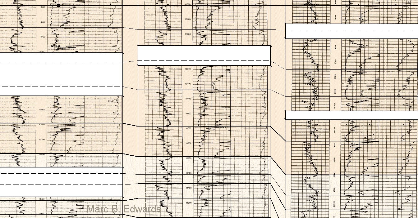
Contemporaneous and post-depositional faulting has resulted in dramatic thickness changes of depositional units and frequent fault cuts which removed section from the well. Interpretation steps such as picking fault cuts and gapping wells for missing section are shown here.
Example Portion of Structural Dip Cross Section
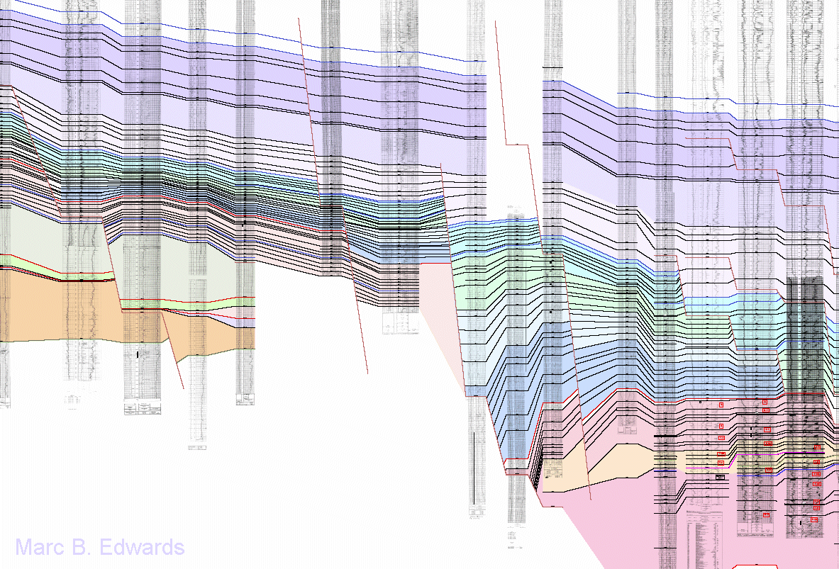
Cross sections include structural and both strike and dip stratigraphic sections. The latter are presented with several datums, each flattened on a different stratigraphic horizon.
Structural sections show faults as interpreted from subsurface correlation.
Stratigraphic sections illustrate a wide range of information, including erosion surfaces and log facies types.
Example Map Integrating Sand Percent, Growth Fault and Blocky/Fining Upward Log Facies
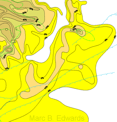
Maps include various combinations of gross isopach, sand thickness or percent, and log facies thickness or percent .
This figure shows a part of one sand percent map.
The green line encloses wells that contain block or upward fining log motif, indicating location of possible channels or valleys.
In addition, key geological features such as active growth faults (blue line) and unconformity terminations are also shown.
Each map shows a type log with the mapped interval indicated.