WILCOX STUDIES | BEE-VICTORIA | ZAPATA | WORKFLOW | INFORMATION
Middle Texas Bee – Goliad – Victoria Phase
Download: Basemap Brochure (PDF ) Sample Well Logs
Key Features:
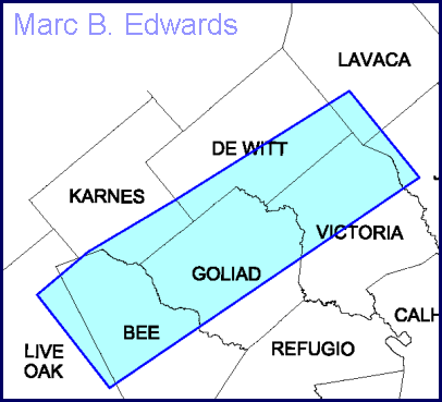
Geographic area covered – emphasis on Bee, Goliad and Victoria Counties with coverage into Karnes, DeWitt and Lavaca Counties.
Stratigraphic units covered – detailed study of Middle and Upper Wilcox with approximately 60 markers. Sample well logs showing the intervals that were interpreted for correlations, fault cuts and sand and log facies are available for downloading.
Database -more than 2,000 wells were interpreted for this study, with results of 1,585 included in this product.
Digital data – all tops (>35,000), fault picks (~800) and sand counts (~35,000) in digital format keyed to API number.
Digital maps and cross sections – all maps and cross sections included as PLT files for plotting on HP plotters, and PDF’s for convenient screen viewing in Adobe Acrobat version 4.
Cross sections – fifty-eight cross sections, including structural, stratigraphic, regional, sub-regional, and local (high-detail).
Maps – Twenty three sand, isopach and log facies maps, and two unconformity maps, at a scale of 1″ = 8,000′.
Stratigraphic framework – diagram of all surfaces and units defined, major depositional systems and environments.
Geohistory – stratigraphic and structural evolution shown step-by-step in large-scale diagram.
Text report – description of methodology and study results. It builds upon reference to previous work. Provided in both DOC and PDF formats.
Media – The above deliverables are provided on CD. The text report and some maps and cross sections are also provided in large-scale plots.
Download a detailed BEE-GOLIAD-VICTORIA BASE MAP in PDF format (915 k) and a PDF Brochure