Effective cross section analysis and display is an essential part of subsurface geological interpretation. Cross sections can be created using a range of technologies, from slipping paper logs to LAS and raster log interpretation in a workstation.
I have been using both techniques for many years. The final cross sections should show the results of the analysis, be presented both structurally and stratigraphically, and should tie completely with the accompanying map interpretation.
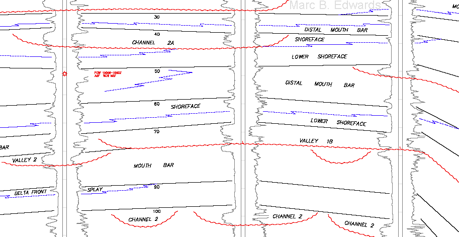
The first example is a series of wells that were originally interpreted on paper, logs were then vectorized, and the sections were built in AutoCAD. A legend to this stratigraphic dip section from the Lower Miocene of SW Louisiana is presented in the Miocene Study section of this web site.
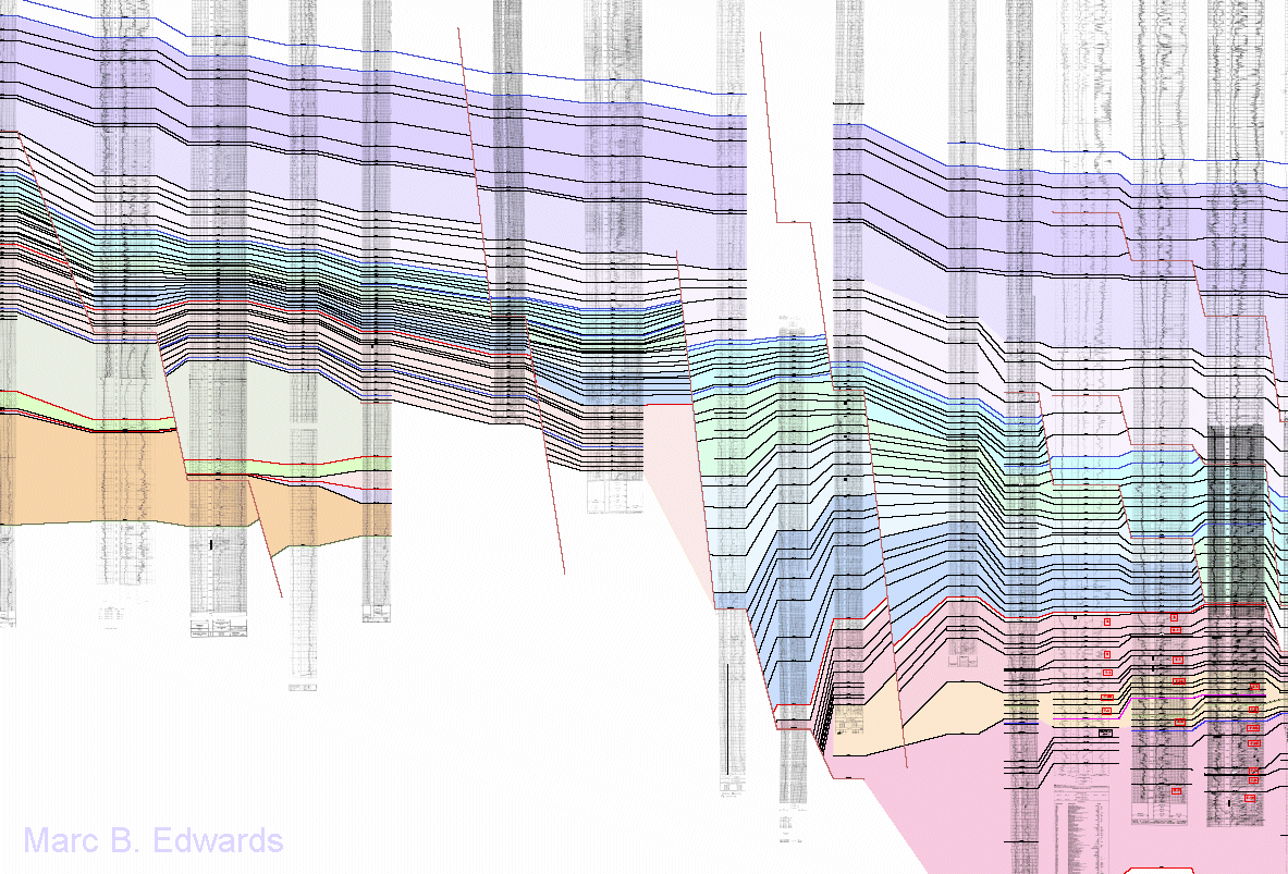
The second example is a complex structural section created in the cross section application developed by A2D Technologies . Here all of the work was performed in the workstation using raster well logs.