A major challenge when conducting subsurface studies with large numbers of wells concerns the efficient and effective application of data posting.
Most posting algorithms do not account for common subsurface conditons such as section being removed by faulting or erosion.
Over the years we have created our own proprietary algorithms that can extract the available formation top/status, fault depth and throw, and sand/log facies interval range. These routines generate values for posting that better describe subsurface conditions. This reduces the time required for checking wells for anomalous values. This is particularly the case in the GOM where it is important to evaluate the effect of faulting and erosion on surfaces, layers and intervals.
These methods have been applied in all of the regional studies produced, and have been applied in selected consulting projects.
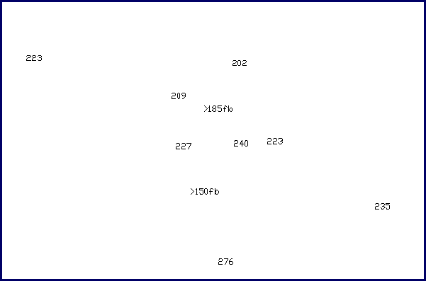
In the gross layer thickness example below, two wells are posted with distinctive, non-numeric values. They indicate that for these wells the base of the layer was removed by faulting, and the minimum thickness of the layer, between the fault cut and the top of the unit, is displayed. Without this logic, values would not have been posted at these wells.
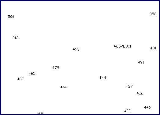
In the second example, below, one well is posted with a non-numeric value which shows both the actual thickness of the layer, as well as the thickness reconstructed by adding the thickness of vertical separation, or missing section). Without this restoration, these data would not have been interpreted appropriately.
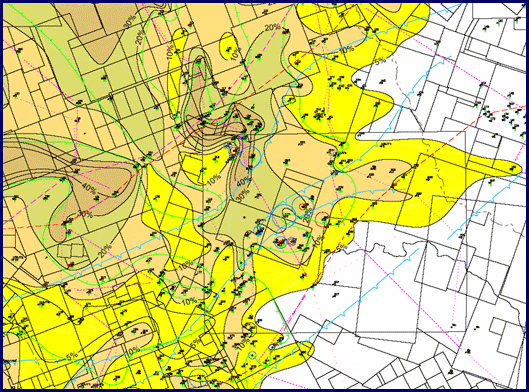
The result of this data posting, integrated with cross section analysis, is presented here. Note the diversity of interpretational information: locations of growth faults, sand percent contours, and limit of fining upward/block log facies suggesting the locations of channel/valley features.