YEGUA STUDY | WHY STUDIES | SPECIFICATIONS | SAMPLES
Images of Key Documents from Miocene Regional Study
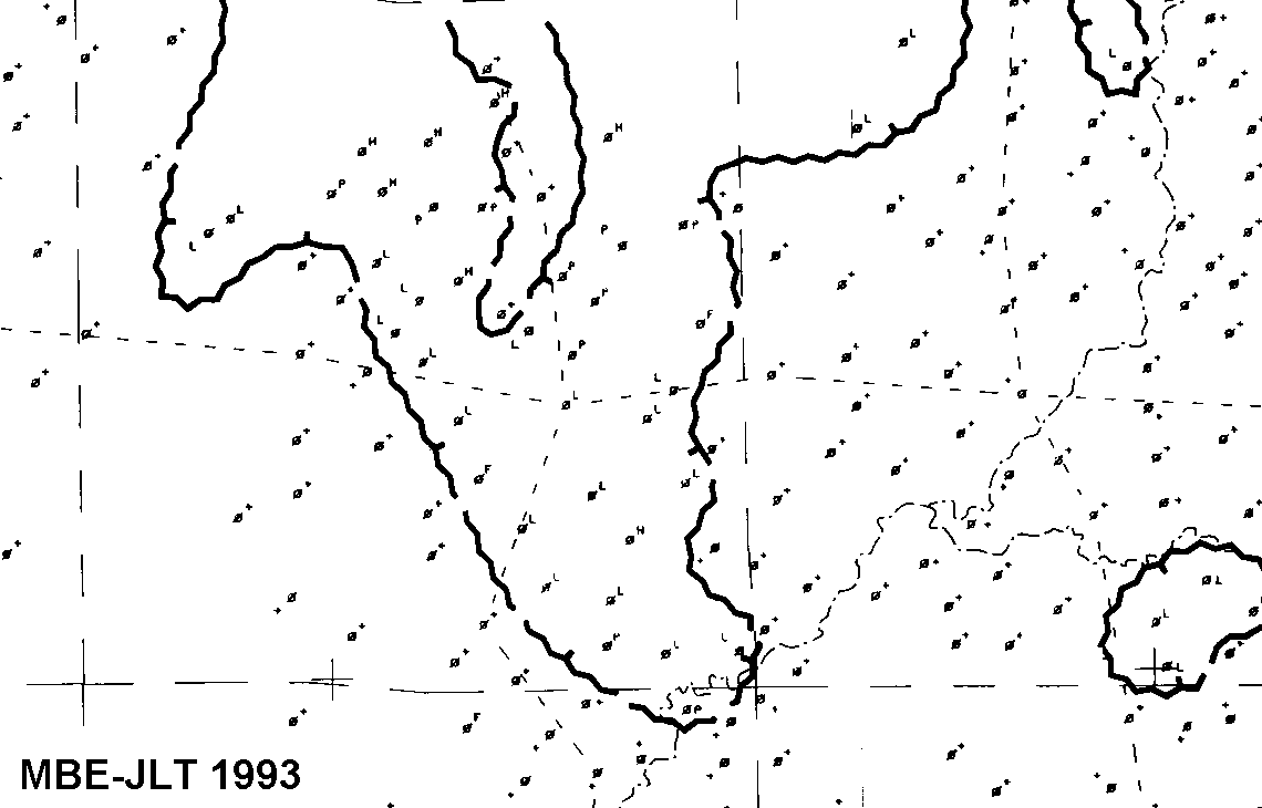
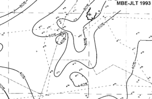
Upper Boundary Map
This identifies the properties of the upper flooding surface of one of 13 mapped units. A plus sign indicates preservation of the surface, whereas letter values indicate post-depositional erosion.Well symbols show production from this unit only. Dashed lines show positions of cross sections.
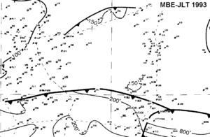
Interval Isopach Map
This is an example of an interval isopach map of one of 13 units mapped in the Miocene study. Well symbols show production from this unit only. Numbers refer to thickness values. Thickness contours were created by hand. Faults are contemporaneous to this unit. Dashed lines show positions of cross sections.
Net Sandstone Map
This is an example of a net sandstone map of one of 13 units mapped in the Miocene study. Well symbols show production from this unit only. Numbers refer to thickness values. Thickness contours were created by hand. Dashed lines show positions of cross sections
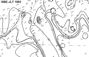
Channel Fill Map
This is an example of a channel fill sandstone (blocky) map of one of 13 units mapped in the Miocene study. Well symbols show production from this unit only. Numbers refer to thickness values. Thickness contours were created by hand. Dashed lines show positions of cross sections. The zig-zag line indicates erosion of the underlying flooding surface.
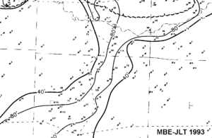
Percent Sandstone Map
This is an example of a percent sandstone map of one of 13 units mapped in the Miocene study. Well symbols show production from this unit only. Numbers refer to thickness values. Thickness contours were created by hand. Dashed lines show positions of cross sections. Solid zig-zag line shows erosion of upper flooding surface.
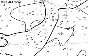
Log Facies Fill Map
This is an example of a log facies map of one of 13 units mapped in the Miocene study. Well symbols show production from this unit only. Codes refer to different categories of electric log facies types. Outlines were created by hand. Dashed lines show positions of cross sections.
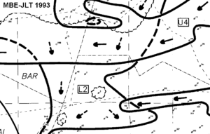
Depositional Synthesis Map
This is an example of a depositional synthesis (paleogeographic) map of one of 13 units mapped in the Miocene study. Well symbols show production from this unit only. Numbers refer to unique well identifier. Depositional features were mapped by hand. Dashed lines show positions of cross sections. The zig-zag line indicates erosion of the underlying flooding surface. Arrows show transport directions. A number in a box refers to a paleogeographic feature depicted in the stratigraphic cross section.
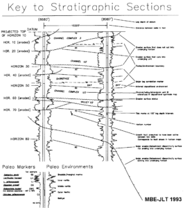
Stratigraphic Section Key
This key shows features present on the stratigraphic sections. In the Miocene study, the logs are the same digitized curves shown in the stratigraphic sections. In the Yegua studies, the logs are photographically reduced from paper originals.
These sections indicate key stratigraphic surfaces, gapped faults cuts, depositional environments, major sand axes keyed to paleogeographic maps, biostratigraphic tops and paleobathymetric curve. Also shown is production data.
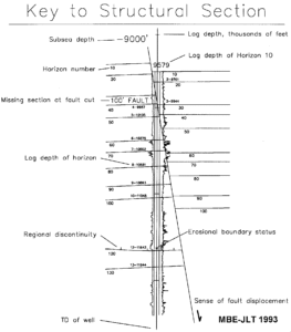
Structural Section Key
This key shows features that are present on the structural dip sections. In the Miocene study, the logs are the same digitized curves shown in the stratigraphic sections. In the Yegua studies, the logs are photographically reduced from paper originals.
The sections show key stratigraphic surfaces, faults and faults cuts for the main study interval.
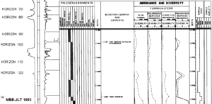
Sample Paleo Display
Paleo displays combine several key elements: 1) reference well log with log marker tops, 2) biostratigraphic tops, 3) paleoenvironmental curve, and for some wells, 4) abundance and diversity curves.
Seismic Line
Part of one of several interpreted seismic panels included with the Miocene study. Interpretation based on detailed log correlation, biostratigraphic control and check surveys.